Legend attributes the name of Puerto Princesa to a princess-like maiden of rare beauty who roams around the bay on certain times of the year during moonlight nights. At other times, she is seen sitting on a rock of the shore of Parola beach looking far out sea, as if waiting for her sailor- love to come home.
Authorities however, contend that the name was derived from the geographical location of the place as a port – being naturally protected from inclemency of the weather all year round. It has sufficient depth to allow ships of all sizes to anchor. It is truly a “Princess of Ports” or in Spanish “Puerto Princesa.”
Historical records, however, show that the place was named in honor of Princess Eulalia of Spain. She was born in 1864 to the Reigning Monarch, Queen Isabela II and her consort Dr. Francisco de Asis. But when the princess met an untimely death, the Queen changed the name to “Puerto de la Princesa.” Eventually, it was reduced to Puerto Princesa as it is known today.
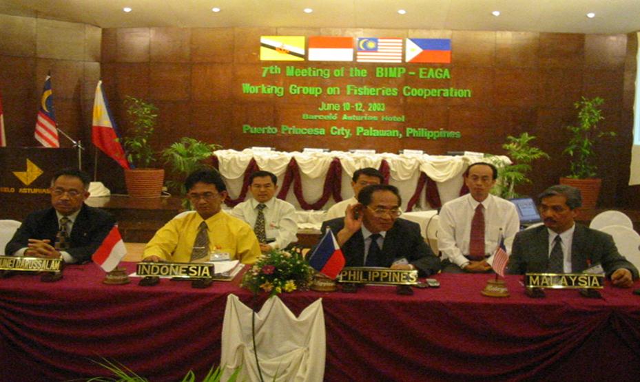
Puerto Princesa City has become the premier tourist destination in the Philippines. It has good access to Southeast Asian sea lanes and is near Vietnam, Malaysia and Brunei. The Brunei-Darrusalam, Indonesia, Malaysia and Philippines East Asia Growth Area (BIMP-EAGA) which brings in, the participation of Puerto Princesa and Palwan in the growth initiative among the four countries has resulted in increased trading activities in the City. The perceived borderless economy has hastened joint venture cooperation, tourism activities and business travel within the area. The upgrading of the Puerto Princesa airport ha s brought about increased air traffic and trade links between Puerto Princesa City and the rest of the region.
Puerto Princesa City is part of Mindoro, Marinduque, Romblon, Palawan (MIMAROPA) Region IV and among the active players in the regional development. Its airport and seaport are among the important transport links in the Region. The City’s inclusion in the Special Zone of Peace and Development (SZOPAD) under Executive Order No. 371 has helped the City Government in its intensified development efforts particularly in the poor and depressed communities. Projects undertaken through the SZOPAD funds include water supply, irrigation, roads and other human development projects.
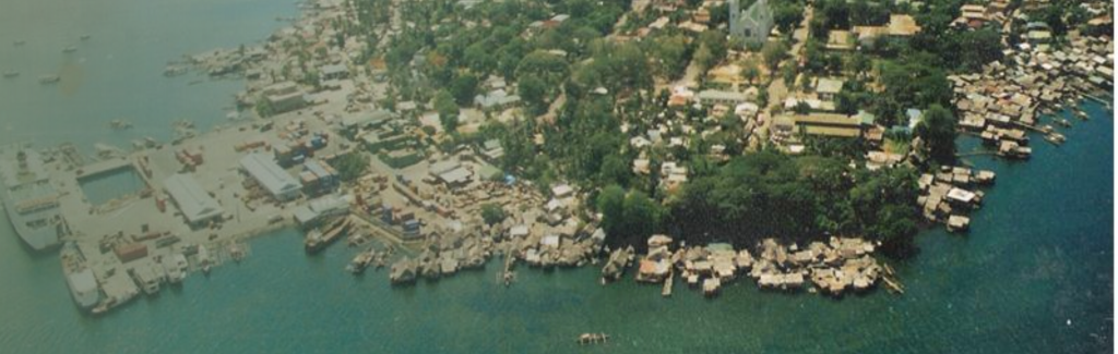
Puerto Princesa is the capital city of the Province of Palawan. It is the center of trade and commerce, communication, education and government service. It divides Palawan into the northern and southern parts. A component city of the province, it constitutes about 17 percent of the total land mass of the province. Puerto Princesa has continued to enjoy the competitive advantage as the main gateway to the rest of the province. Thus it provides a good share of revenue benefits for its inhabitants. Under the law, Puerto Princesa will have a financial share in the revenue benefits that Palawan gets from the operation of the Malampaya Natural Gas Project.
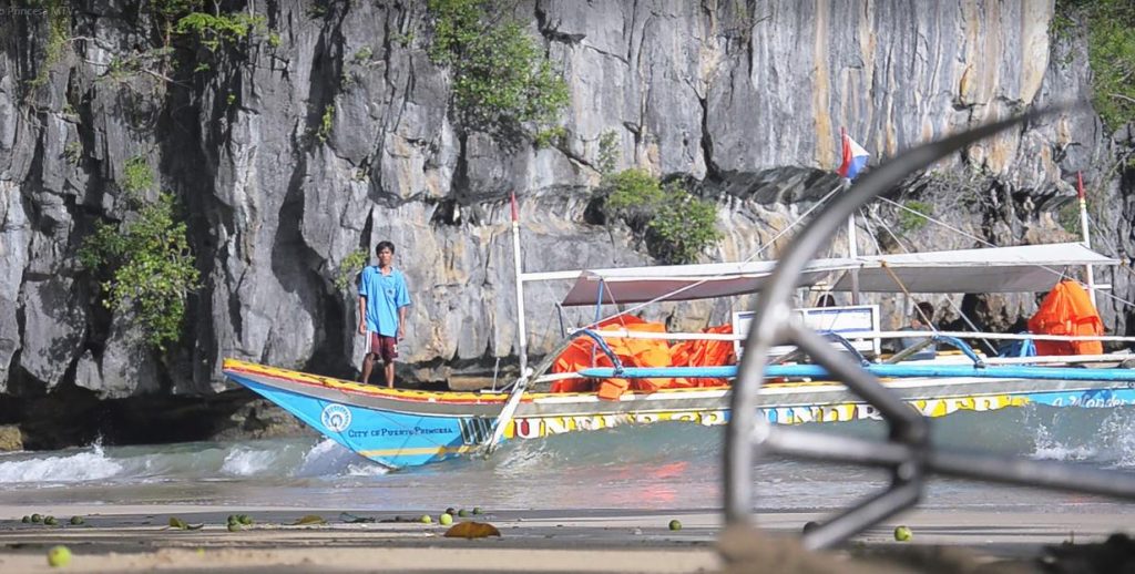
Puerto Princesa City lies in the heart of the long and narrow island Province of Palawan. It is approximately 306 nautical miles from Manila, 206 to Panay Island and about 250 to Zamboanga. It is 55 minutes by commercial airlines to Manila. It takes 18 to 20 hours by sea aboard the modern shipping lines that service the area from Manila and is about almost the same travel time from Negros Island.
The territorial jurisdiction of the City is bounded on the north by the Municipalities of San Vicente and Roxas and on the south by the Municipality of Aborlan. Its western side is the coastline of the South China Sea and on the east lie the Sulu Sea.
It is considered one of the largest cities in the country with a land area of 253,982 hectares or 2,539.82 square kilometers stretching over 106 kilometers long with its narrowest breadth of 8.5 kilometers at Barangay Bahile. Apportioned to 66 barangays of which 35 are urban while 31 rural.
While large in size, only 1.8 percent of the area is inhabited and a forest cover of 151,405 hectares, believed to be the biggest in any city in the Philippines. Puerto Princesa is aptly referred to as the “Princess City in the Last Frontier” of the Philippines.
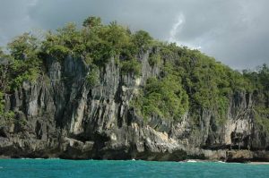
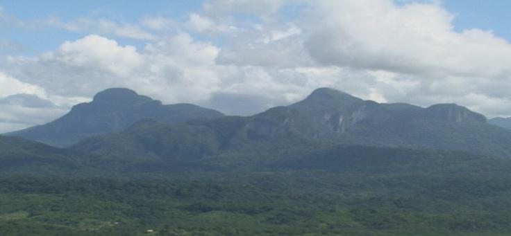
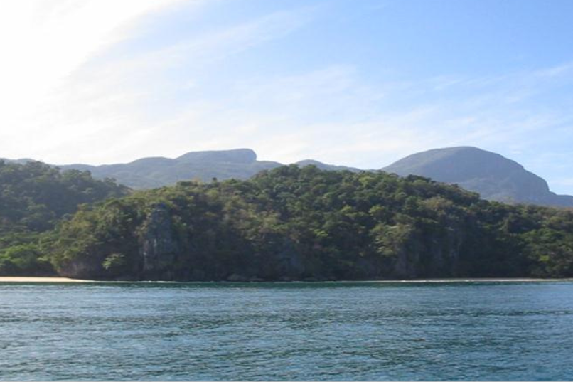
From the town, a chain of tall and majestic mountain ranges could be seen: towards the northwest, Mount Pulgar (1,208 meters) and Beaufort (1,121 meters); towards the southwest, the Cordillera of the Aldea and the Tres Pisos. The mountain ranges traverse the entire central length of the City, dividing it into two distinct areas: the east and the west coasts. The eastern side is characterized by thin strandlines bordered by swamplands, following a series of wide flat plains to hilly terrain. The west coast has less to offer, being pinched by craggy foothills and rugged mountains close to the sea. Generally, the terrain ranges from 10 to 1000 meters above sea level with rugged mountain areas in the interior. Its highest peak is Cleopatra’s Needle at 1,605 meters. The City has large productive areas of diverse marine ecosystems that provide shore protection and main source of food and employment in the fisheries and tourism sectors. Its coastline stretches over 416 kilometers and its coastal waters cover an area of 327, 586 hectares. Its mangroves which are important links between the shore and coastal ecosystems, cover an area of 5,917 hectares. Presidential Decree No. 2152 of 1982 declared the whole province of Palawan including Puerto Princesa City a mangrove reserve area. The vast Iwahig Prison and Penal Farm which has an area of 29,768 hectares offers good opportunities for farming of selected crops, livestock raising and other agricultural development. Negotiations on the plan to place the National Prison and Penal Farm under a joint management of the Department of Justice (DOJ) and the City Government of Puerto Princesa are underway. It is envisioned that Iwahig accommodate its resident prisoners in one portion of the area leaving vast lands available for sustainable agricultural activities that will greatly benefit the City’s economy.
Puerto Princesa enjoys good climatic conditions. It is outside the typhoon belt of the Philippines and is rarely affected by the direct and strong winds of a typhoon.
The City has a uniform high temperature. Generally, the warmest months are March, April and May. The coolest are November, December, January and February.

Puerto Princesa is a melting pot of people with different cultures. This is attributed to the influx of migrants from other Philippine provinces.
Puerto Princesa enjoys good climatic conditions. It is outside the typhoon belt of the Philippines and is rarely affected by the direct and strong winds of a typhoon. The City has two prevailing types of climate. The type that prevails in the west coast has two distinct seasons: six months dry (November-April) and six months wet (May-October) with the heaviest record rainfall in September. The lowest or driest months occur in February. Western Barangays New Pangangan, Marufinas, Cabayugan, Tagabinet, Buenavista, Bahile, Macarascas, Simpocan, Bagong Bayan and Napsan fall within this type. On the other hand, the east coast has a short dry season with varying heavy rainfall months. Dry months have been recorded during the months of January to April. It has two prevailing winds: the northeast (NE) monsoon and southwest (SW) monsoon. Northeast monsoon generally set in October and continues until April. It blows between north and northeast with a tendency towards an easterly direction at the end of the season. It has a velocity ranging from 15 to 25 kilometers per hour at its height and an average of six kilometers per hour. Rain clouds during the northeast monsoon practically lose all the moisture before reaching the southwest part of the archipelago. Thus the City and the Province as a whole receive no rainfall towards the end of the NE from January to April. The southwest of summer monsoon follows the NE after a transition period of variable winds and calms. It prevails from June to October. It blows most steadily during July and August reaching a maximum velocity of about 35 kilometers per hour. In October or during the close of the SW monsoon, strong winds occur in the southern part of the City. The SW winds bring torrential rains but with uneven distribution. Slight winds are present with some regularity during the two monsoons from December to April the northeast winds predominate. They usually affect the sea, making it rather rough. The southwestern winds predominate during the months of July up to the end of October, but with less intensity as the northeastern winds. With the change of winds come slight tempests that bring a sudden rush of winds with slight rains accompanied by thunder. These lightning and thunder do not usually cause accidents or calamities, since they are effected on the peaks of the mountains, which by their natural location and proximity to the shores, serve as natural lightning barriers to protect the inhabitants in the coastal areas. The NE and SW monsoons affect the eastern and western part of the City. When these winds blow, the seas are very rough. The calm months of the year are from April through June on both the eastern and western side of the City.
The City has a uniform high temperature. Generally, the warmest months are March, April and May. The coolest are November, December, January and February. It has more or less uniform as well as high relative humidity that range from 79 to 80 percent with an annual mean of 84 percent.
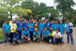
Puerto Princesa is a melting pot of people with different cultures. This is attributed to the influx of migrants from other Philippine provinces, one of the reasons for the City’s high annual growth rate at 6.5 percent. The 2000 National Statistics Office (NSO) census show that it has a total population of 161, 912 of which 121,748 urban and 40,164 rural with 33,306 households. The predominant local tongue is Cuyono. However, other languages like English and Filipino and dialects such as Cebuano, Ilocano and other dialect groups. But Filipino emerged as the common language of communication. The people are predominantly Roman Catholics but all other religions as Islam, Jesus is Lord, Baptist, Iglesia ni Christo, etc. are practiced freely. While Puerto Princesa is a culturally rich, lively and diverse community, there is respect for individual worth, tolerance of differences between people and collective responsibility for common goals. People have high regard for the environment and recognize the consequences of previous environmental neglect and lack of respect for natural resources. Despite the rise in petty crimes, drug problem and vices, the peace and order situation in the City compares more favorably with most cities in the country and makes the City a fertile ground for investments. Its crime solution efficiency rate of 98 percent was the highest in Region
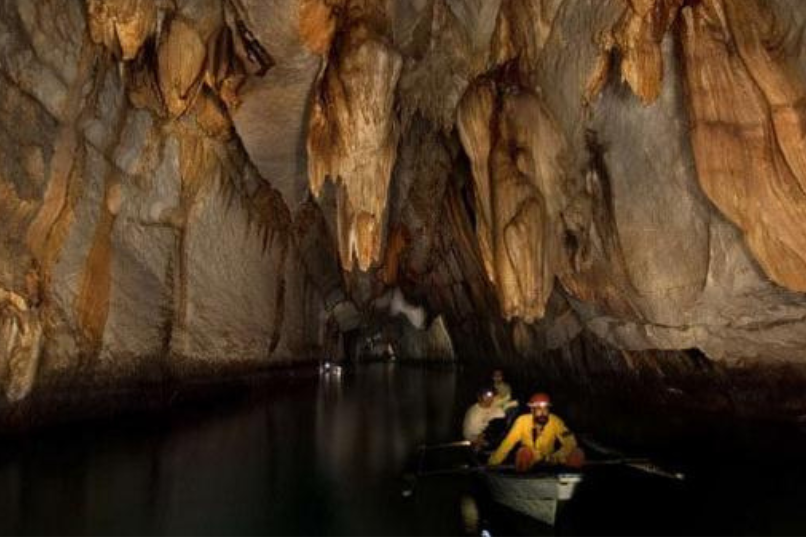
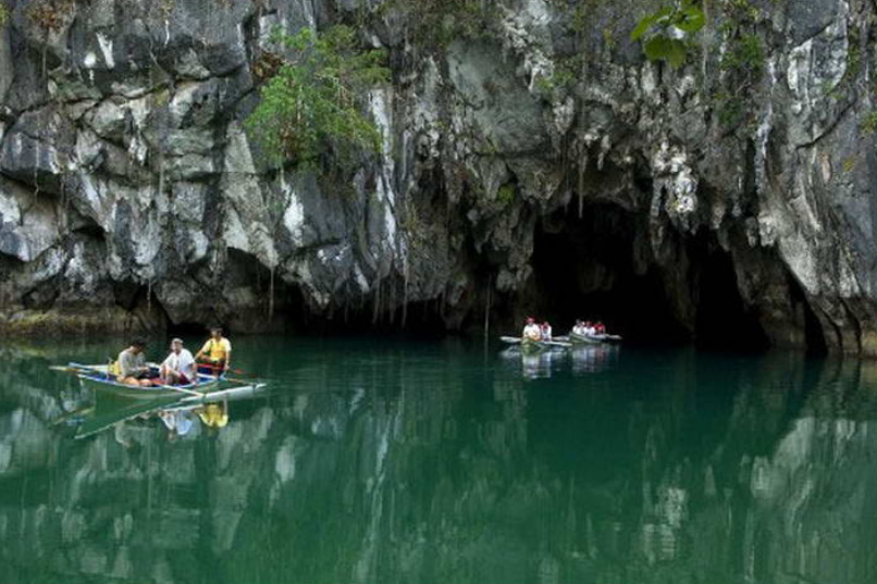
Outstanding among the scenic spots is the “eighth wonder of the world” – the Underground River at St. Paul’s Bay. A visitor once described the scenic beauty in these words: Nothing but an artist’s pencil could tell the story. Photographs give the outlines and convey no adequate conception of the marvelous detail of line and color. Nature’s sculpture is everywhere.
The scene changes . . .the note becomes that of ancient Egypt. Carved by time itself, unaided by the hand of man there reposes a complete and finished griffin (or is it a sphinx by time as amid thesands of time?). Between stately stone pillar rise a series of steps leading from the water to some temple within.
Then the cavern stretches away an almost perfect rectangle with walls and ceiling decorated with many colors- - surely the deft work of an artistic, designing hand. One sharp turn of the way and there appears a huge stalactite glittering like a chandelier from the ceiling of some great ballroom. Suddenly the boat glided into a great chamber resplendent with colors and decorations like a stage set for a scene in some grand opera. (Brochure. Palawan: The Last Frontier 3).
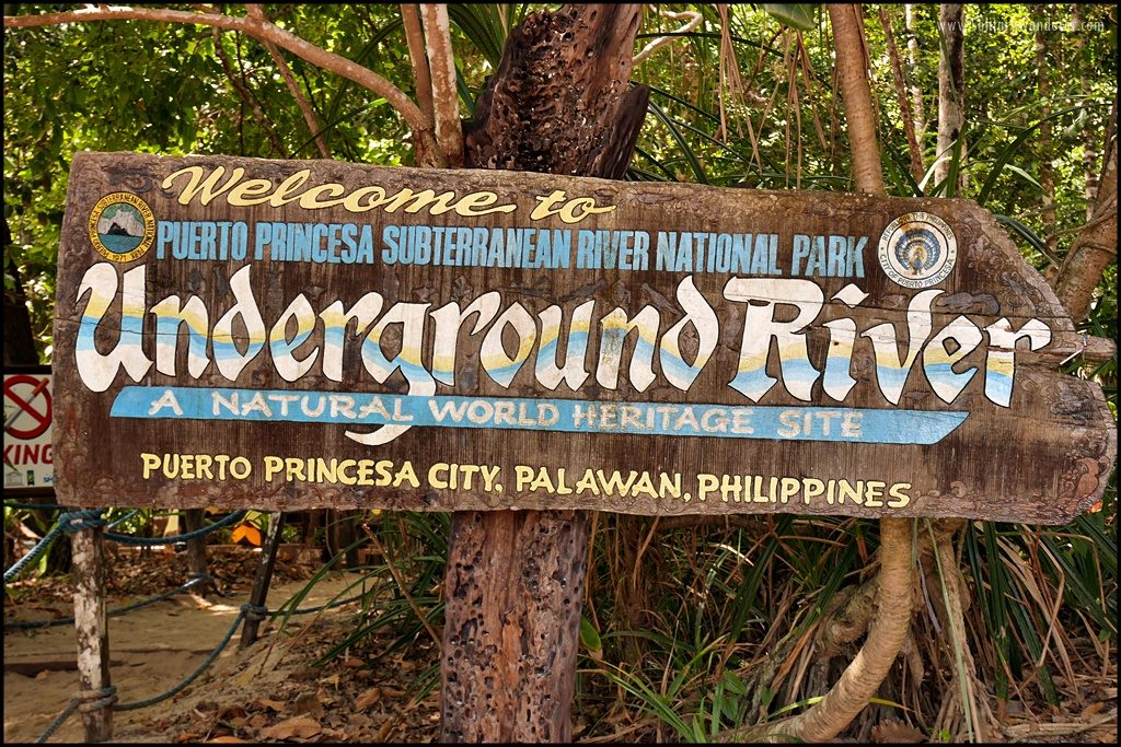
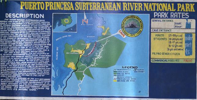
The Puerto Princesa Subterranean River National Park was inscribed on December 4, 1999 by the United Nations Educational and Scientific and Cultural Organization (UNESCO), a World Heritage Site, on the merit of its magnificent subterranean river with unique natural formations that empties into the sea. Furthermore, the whole Park, with the exception of small areas near the underground outflow and the administrative area of the Central Park Station, is covered by primary forest which is home to many endemic species of animals and plants. This dense tropical forest which forms the watershed area of the river is within the boundaries of the Park. It also encompasses an unusually wide variety of ecosystem. It is therefore of high scientific and conservation interest.
The PPSRNP is the only national park in the Philippines situated within the city’s boundaries. Thus, all the environmental preservation programs and maintenance are meticulously undertaken by the City of Puerto Princesa under the leadership of Mayor Edward Solon Hagedorn, whose successful environment programs have won national and international awards for the city government. At Marrakesh (Morocco) the UNESCO World Heritage Committee inscribed PPSRNP on the World Heritage List with this inscription:
“The PPSRNP features a spectacular limestone karst landscape with its underground river. A distinguishing feature of the river is that it emerges directly into the sea, and the lower part of the river is subject to tidal influences. The area also represents a significant habitat for biodiversity conservation. It contains a full “mountain-to-the-sea” ecosystem and protects some of the significant forests in Asia” On December 11, 2003, the PPSRNP was also proclaimed a “National Geological Monument” by the National Committee on Geological Sciences in recognition of its scientific importance as a permanent laboratory for studies on geological processes, uniqueness and high scenic value.
The St. Paul Subterranean River has a very long history. Commander Bates of the English navy, while exploring the coast of Palawan in 1850 saw the subterranean river. He named it St. Paul for he likened it to the dome-shaped St. Paul Cathedral in London.
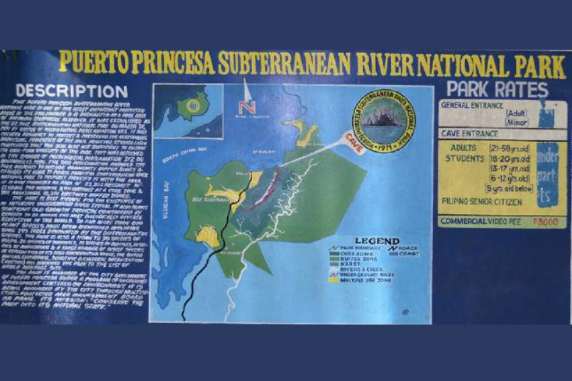
The Batak tribe lives in the area call the subterranean river as Natuturingan Cave, because of their fear of of spirits and animals living inside the caves prevented them from going inside its depths. Located at the west coast of the long strip of island of Palawan, some 81 kilometers from Puerto Princesa City proper, the St. Paul Subterranean River National Park (SPSRNP) was established on March 26, 1971 by virtue of Presidential Decree (P.D.) 835 to protect its unique and cultural features. Originally, it encompassed 3,901 hectares.
In conformation with Republic Act No. 7160 of 1991 or the Local Government Code, the Department of Environment and Natural Resources (DENR) in a Memorandum of Agreement transferred the responsibility of the management, protection, rehabilitation and development of St. Paul National Park to the City Government in 1992.
Then on November 12, 1999, the President of the Philippines signed Proclamation No. 212 renaming the St. Paul Subterranean River National Park to Puerto Princesa Subterranean River National Park (PPSRNP) and expanded its area of coverage from 3,901 hectares to 22,203 hectares.
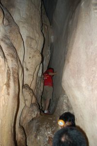
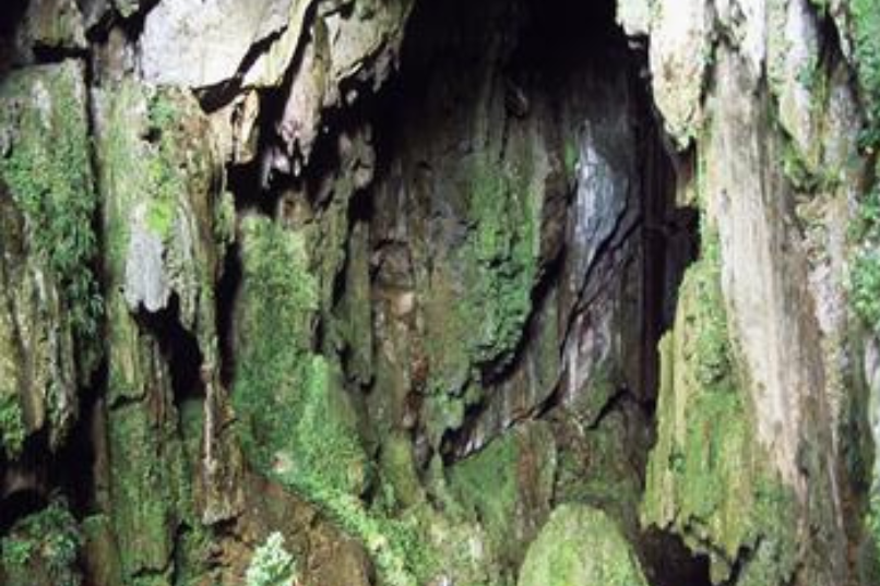
The first documented exploration inside the cave was led by Dean Worcester, an American, in 1887. The cave has a total surveyed length of 22 kilometers, making it the longest cave in the Philippines. The navigable portion is 8.2 kilometers. The gray rocks, making the walls are called limestone. They were formed under the sea about 23 million years ago. Changes in the earth caused the limestone to be exposed above the sea, allowing rain water to move through the small cracks in the rocks and dissolve the limestone much like hot water melting a block of ice. It took rain water thousands or even millions of years to enlarge the cracks into the passages as caves. The yellow rocks are called cave formations. The St. Paul Underground River is part of the Cabayugan River which disappears into the ground and becomes the St. Paul Underground River.
Inside the cave is a large formation called “Cathedral” because it resembles the dome of a huge cathedral. At the right of the cathedral is a formation which resembles the Virgin Mary and a Giant Candle, these are examples of stalagmites. They were formed from water dropping from the ceiling to the floor which left behind minerals that dissolved it into calcite. This is a very slow process, the changes of which cannot be noticed even in a lifetime. The estimated normal rate of growth of these formations is only a fraction of a millimeter per year.
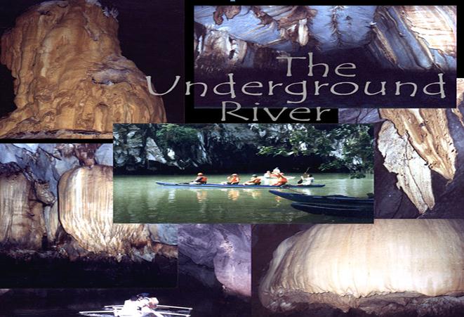
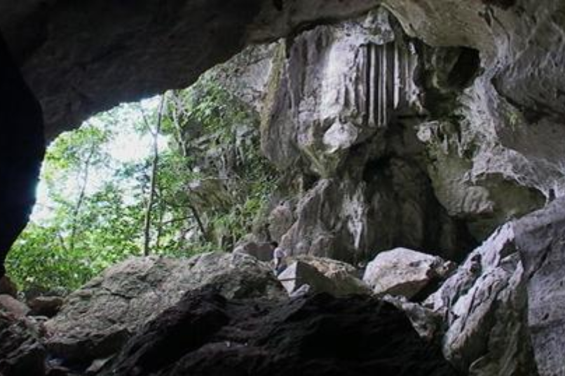
The candle is called stalactite. This was formed when water escaped the cracks in the ceiling which left behind some minerals before it dropped to form a stalagmite. The formation of jellyfish inside is an example of a flowstone. It was formed when water flowed on the walls of the caves and left a blanket of minerals. The giant mushroom is a beautiful flowstone. There are a series of blankets called growth rings which were formed over the previous blankets. The highest point is 65 meters above the water level. This was formed due to the abundance of cracks in the area and the fast flow of rain water. At the walls are a series of grooves. These are called notches and were formed by water. This indicates that the water level was once at that level.
The small stalactites are called soda straws because they resemble straws’ hollow centers where water flows through in droplets. The Highway is 200 meters portion of the cave which follows the large cracks, a result of the flow of rain water through the cracks. The thin formations found on the parallel walls of the highway called curtain or draperies. They are special type of flowstone. They are also called bacon as they look like it. The black and white lines that make the curtain resemble that of a bacon, was caused by the flow of the water over the thin portion of the walls. The weird stalactite in the cave is called Egret because of its eccentric formation which is different from the other stalactites. This was formed when the water droplet hanged on for a long time before it dropped that allowed the wind to move it from side to side where it left behind the dissolved minerals.
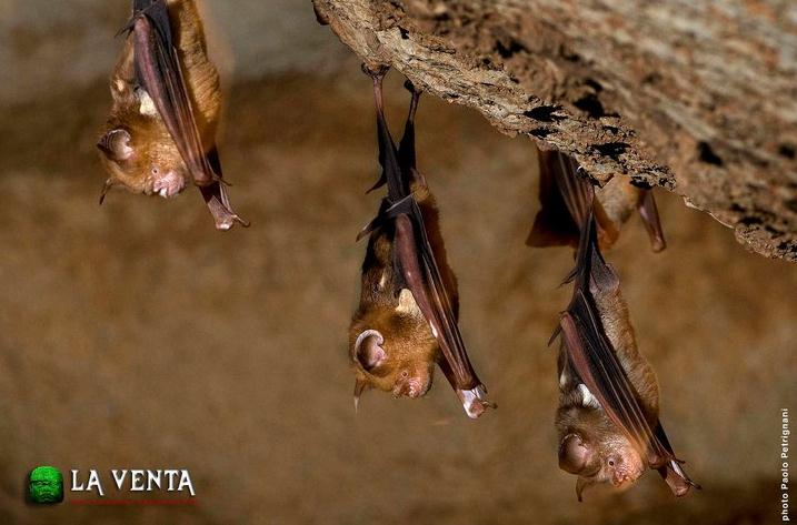
The bats and swifts found in the cave, live part of their lives inside and outside the cave. They leave the cave only to look for food.
The limestone of Ulugan Bay and the limestone of Bacuit Bay are two totally separate rock formations.
Its main feature is an 8.2 kilometer long underground river that flows toward the South China Sea unde.
The bats and swifts found in the cave, live part of their lives inside and outside the cave. They leave the cave only to look for food. They rest and breed inside the cave. They are called troglophiles. They use sound, called echolocation, to fly and locate themselves in the dark. There are 65,000 of individuals of eight species of bats and at least two species of swiftlet roost in the cave. The other animals that live throughout their lifetime in the cave are called troglobites. While those who only visit the cave for short time called trogloxenes, such as snakes and other fishes. Occasionally, shrimps and eels are found inside. It is not known whether or not they stay permanently in the cave or just washed in from the open sea.
The limestone of Ulugan Bay and the limestone of Bacuit Bay are two totally separate rock formations. They are also ages apart, the one in Puerto Princesa is only 50 million years old while the one in El Nido is 250 million years. If the St. Paul Limestone Rock Formation is an iceberg, then Mt. St. Paul is only its tip. The main body of the rock formation is under the sea and extends all the way to the Malampaya oil fields of Palawan. It is in fact the reservoir rock for Palawan’s offshore petroleum. If this is difficult to believe look at a map of the world and note how tiny the entire archipelago of Palawan is compared to Saudi Arabia. The reservoir limestone formation of Saudi Arabia petroleum is even more extensive than the St. Paul limestone. Unfortunately, the petroleum maps of the Malampaya oil field has been erroneously referred to as El Nido limestone instead of St. Paul limestone.
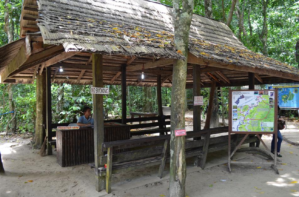
Its main feature is an 8.2 kilometer long underground river that flows toward the South China Sea under a spectacular massif limestone or karst known as the St. Paul Mountain Range, rising 1,028 mouth is a clear lagoon teeming with brackish water fish and other forms of marine life. A white sand meters above sea level. The river is claimed to be the longest in the world. At the entrance of the river’s beach clumped by ancient trees meanders at the water’s edge. Monkeys, monitor lizards and squirrels find their niche on these trees. The lowest four-kilometer of the river is navigable by small boats and now attracts 40,000 visitors annually generating considerable revenue, equivalent to over 80 percent of Park expenditure. The Park strictly enforces a “NO PERMIT, NO ENTRY” policy. Visitors are required to register and given a short briefing at the Park Headquarters before being allowed to proceed to the Park area. Apart from the underground river, are other attractions where community guides are available. The tour guides are out-of-school youths who have been trained for the purpose. These are: JUNGLE TRAIL The Park’s 1.5 kilometers Jungle Trail is a good treat to hikers and trekkers. Guided only by orange marks on trees, this trail leaves one to explore on foot the Park’s intact tropical rainforests. The Park’s diverse form of land systems represents all except two of the lowland forest formations of the tropical Far East Asia.
An alternate route to the underground river is through the Monkey Trail.
It takes about one hour and 30 minutes hike from the main road in Cabayugan to the foot of the Daylight Hole.
The cave is eight kilometers away from Sabang. It is 200 meters from the side of the national highway.
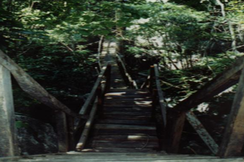
An alternate route to the underground river is through the Monkey Trail. A four-kilometer trail passing Sabang beach leads to the interior forest of the park where monkeys and other forms of wildlife may be seen. The two-hour hike ends in the 355 wooded and paved steps up toward the underground river. The climb atop the steps gives the hiker a fresh view of the Park over the karst. Note: Beware of playful monkeys
It takes about one hour and 30 minutes hike from the main road in Cabayugan to the foot of the Daylight Hole, which is found at the top end of a 150-meter climb up the karst. So-named because of the large hole that opens to the sky at the end of the cave’s high and wide mouth. This is where the sunlight streaks through forming a cascade down to the bottom of the limestone wall. The hole provides the only ray of light to the visitors paddling their way in the long, pitch-black river underneath. The trail to the Daylight Hole passes by the inflow, the point where Cabayugan River disappears through the massive limestone walls and continues inside forming the underground river
Its main feature is an 8.2 kilometer long underground river that flows toward the South China Sea under a spectacular massif limestone or karst known as the St. Paul Mountain Range, rising 1,028 mouth is a clear lagoon teeming with brackish water fish and other forms of marine life. A white sand meters above sea level. The river is claimed to be the longest in the world. At the entrance of the river’s beach clumped by ancient trees meanders at the water’s edge. Monkeys, monitor lizards and squirrels find their niche on these trees. The lowest four-kilometer of the river is navigable by small boats and now attracts 40,000 visitors annually generating considerable revenue, equivalent to over 80 percent of Park expenditure. The Park strictly enforces a “NO PERMIT, NO ENTRY” policy. Visitors are required to register and given a short briefing at the Park Headquarters before being allowed to proceed to the Park area. Apart from the underground river, are other attractions where community guides are available. The tour guides are out-of-school youths who have been trained for the purpose. These are: JUNGLE TRAIL The Park’s 1.5 kilometers Jungle Trail is a good treat to hikers and trekkers. Guided only by orange marks on trees, this trail leaves one to explore on foot the Park’s intact tropical rainforests. The Park’s diverse form of land systems represents all except two of the lowland forest formations of the tropical Far East Asia.
Formerly known as the Central Park Station, the area has been converted into a restoration zone.
Princesa Subterranean River National Park (PPSRNP) is the Mangrove Interpretative Paddleboat Tour.
The site museum in Barangay Cabbayugan , right in the heart of the Puerto Princesa Subterranean River National Park.
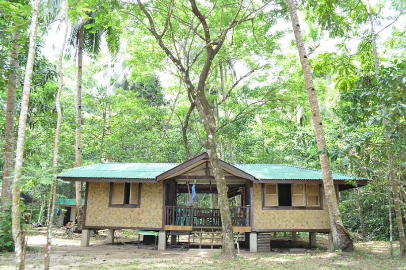
Formerly known as the Central Park Station, the area has been converted into a restoration zone and renamed Malipien Ranger Station. It is the habitat of some of the City’s and Province’s endangered species such as the cockatoo o r katala, scaly anteater or balintong and the Palawan porcupine or durian, to name a few. The Central Station used to provide the only accommodation for Park visitors in the early days when the Park was created in 1971. Transport then to and from the Park was difficult by sea enroute Ulugan Bay in Barangay Bahile.
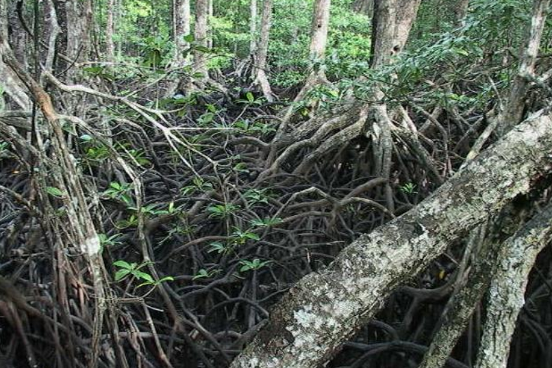
Princesa Subterranean River National Park (PPSRNP) is the Mangrove Interpretative Paddleboat Tour, a 45-minute tour through the Sabang River in Barangay Cabayugan. It showcases the Park’s almost four hectares of century-old mangrove forests. Paddleboats with a carrying capacity of eight persons and operated by trained oarsmen take walk-in visitors to a tour through the four- kilometer long Sabang River. With the package is an interpreter-guide who explains the mangroves ecological importance, uses and its significance for conservation. The tour employs out-of-school youths as guides and boat-paddlers The project is an initiative of the Puerto Princesa Subterranean River National Park under the City Government of Puerto Princesa City in cooperation with the Conservation International (CI), the Palawan Conservation Corp (PCC) and the local communities of Barangays Cabayugan and Tagabinet.
The site museum in Barangay Cabbayugan , right in the heart of the Puerto Princesa Subterranean River National Park (PPSRNP) presents two very distinct ethnic groups: the Batak and Tagbanuwa. These two groups show different cultural perspectives that play a major social context in Palawan and Puerto Princesa City in particular, in the conservation and preservation of their living heritage. The Bataks, the smallest of the Palawan ethnolinguistic groups are rapidly disappearing. There are approximately 1,780 Bataks occupying 13 settlements located along the seacoast and in the interior mountains of Puerto Princesa, between the Babuyan River and Barangay Malcampo. Their language is Atronesian in origin. On the other hand the Tagbanuwa is one of the few remaining ethnolinguistic groups in the Philippines still using a type of syllabic writing which was widely spread in the country prior to the coming of the Spaniards. Their system of writing has been declared in 1999 by the UNESCO as “Memory of the World.”